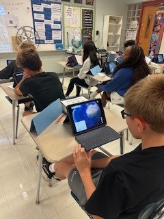
Students in Mrs. Welka’s seventh-grade Ancient Empire class are learning about longitude and latitude and how these conceptual lines form an imaginary grid on the surface of the earth. These lines are used to find absolute location. Students used Google Earth’s latitude and longitude feature to locate specific places around the world by typing in coordinates and dropping placemarks. They practiced finding famous cities, landmarks, and even Shaler Area Middle School using the grid system. This helped them understand how every spot on Earth has a unique “address.” Interactive maps, such as Google Earth, make learning more exciting and hands-on.
Students gained a deeper understanding of geography and technology. Students are very familiar with navigational devices and tracking apps, such as Life360, but some do not fully understand how the apps work. Some students did not realize Life360 primarily relies on your mobile device’s GPS to get real-time latitude and longitude coordinates of the device’s location.